Bendigo sits on the Ordovician turbidites of the Lachlan Fold Belt, with metamorphosed sandstones and slates overlain by 5 to 15 meters of colluvium and alluvium in the valley floors. The shallow groundwater table—often encountered between 3 and 8 meters—complicates foundation design and excavation stability. We deploy electrical resistivity tomography and Vertical Electrical Sounding (VES) to map lateral and vertical resistivity contrasts, identifying bedrock geometry, paleochannels, and zones of water saturation before drilling a single borehole. Complementing this with SPT soundings gives us a direct measure of density where resistivity anomalies suggest weak zones, while MASW surveys cross-validate the depth to seismic bedrock for dynamic analysis.
A single VES line can detect a buried mine shaft at 12 meters depth, saving thousands in unplanned foundation redesign.
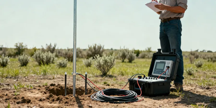
Method and coverage
Bendigo’s gold rush heritage left a legacy of shallow workings, adits, and backfilled shafts that are invisible from the surface. When we run a VES line across a proposed subdivision or commercial lot, we look for sharp resistivity lows that indicate loose fill or voided ground. The method uses a DC current injected through two outer electrodes while a receiver pair measures the potential difference; by expanding the array stepwise we sound deeper. For urban sites where access is tight, we use a Wenner-Schlumberger configuration that delivers stable readings on asphalt or compacted gravel. All processing follows the methodology outlined in AS 1726, with inversion software generating 2D resistivity sections down to 30+ meters. On larger rural blocks we couple this with georadar (GPR) to resolve near-surface utility conflicts before mobilising the resistivity kit.
Technical reference image — Bendigo
Regional considerations
In Bendigo, the biggest hazard we see is uncharted mining voids. The old gold mines collapsed or backfilled with loose debris create resistivity anomalies that look like clay lenses unless you know the local geology. We cross-check every resistivity low against the historical mine plans held by Geological Survey Victoria. If the anomaly persists, we flag it for a confirmatory borehole before any footing design proceeds. The cost of missing a void far exceeds the price of a VES line.
Multi-electrode arrays producing continuous cross-sections down to 30 m. Ideal for bedrock mapping, groundwater exploration, and void detection on greenfield and brownfield sites.
02
Vertical Electrical Sounding (VES)
Single-point depth sounding using expanding electrode arrays. Used for layering identification, depth to water table, and preliminary geotechnical classification prior to intrusive investigation.
03
Resistivity for Pipeline & Utility Corridors
Linear surveys along proposed pipeline, road, or cable routes to identify corrosive soil zones, buried obstacles, and variable ground conditions. Delivered with GIS-compatible sections.
Standards that apply
AS 1726 – Geotechnical site investigations, AS 1289 – Field measurement of soil resistivity, AS 4678 – Earth retaining structures (contextual for void assessment)
Q&A
What is the difference between 2D resistivity imaging and VES (Vertical Electrical Sounding)?
2D imaging uses multiple electrodes along a line to generate a continuous cross-section, revealing lateral changes in soil and rock. VES expands electrodes from a fixed centre point to sound vertically, giving a 1D layered model at that location. In Bendigo, we use VES for quick depth-to-bedrock checks and 2D imaging for mapping paleochannels or mine shafts across a site.
How much does an electrical resistivity survey cost in Bendigo?
A typical VES or 2D resistivity survey for a residential or light commercial lot ranges between AU$1,030 and AU$1,740, depending on array length, number of lines, and site access. Larger infrastructure spreads or combined GPR/resistivity campaigns are quoted per linear metre with a site mobilisation fee.
Can resistivity surveys detect old gold mine shafts in Bendigo?
Yes, but it requires careful interpretation. A backfilled shaft appears as a low-resistivity anomaly often 2–5 m wide, similar to a clay pocket. We overlay historical mine plans and cross-check with local geological maps. If the anomaly is ambiguous, we recommend a confirmatory borehole or a follow-up MASW survey to verify the void.